Glacier Guides & Montana Raft Blog
Glacier Guides & Montana Raft Blog
Glacier Guides & Montana Raft makes monthly contributions to this blog with subjects on all things rafting, hiking, fishing, biking and lodging in and around Glacier National Park as well as relevant news and information about Glacier National Park.
Categories:
- Animals of Glacier Park
- Backpacking Glacier National Park
- Backpacking Information
- Best hiking Glacier National Park
- Biking
- Editorial
- Fishing
- Glacier Guides Montana Raft Co. History
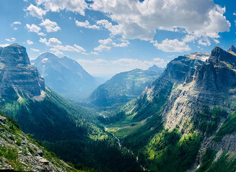
- Glacier National Park
- Glacier National Park Fall
- Glacier National Park History
- Glacier National Park Partners + Friends
- Glacier National Park Spring
- Glacier National Park Winter
- Guide Information
- Guided hiking Glacier National Park
- Hiking
- Hiking Glacier National Park
- Rafting
- Travel Information
- Two Medicine
- Uncategorized
- Yellowstone National Park

Self-Guided Bike Tour Glacier National Park
In the months of May and June (and sometimes early July!) the place to be is Going-to-the-Sun Road on a bike or an e-bike. Biking the Going-to-the-Sun Road is definitely a bucket list activity, especially in the spring before it opens to cars. We guide this incredible adventure and it’s an experience we would wish… Read more »
Calgary to Glacier National Park: A Cross-Border Road Trip into Mountain Majesty
If you’re looking to turn your Alberta summer into a rugged mountain escape, a road trip from Calgary to Glacier National Park is the perfect adventure. In just a few hours, you’ll swap Calgary’s urban energy for alpine lakes, towering peaks, and some of the most stunning scenery on either side of the border. Route… Read more »
The Ultimate Road Trip from Minneapolis to Glacier National Park: A Journey into the Wild
If you’re itching for a true American road trip packed with wide-open highways, rugged mountain views, and untamed wilderness, driving from Minneapolis to Glacier National Park should be at the top of your bucket list. It’s not just a trip—it’s a full-blown adventure. Route Overview From Minneapolis, you’re looking at around 1,100 miles one way,… Read more »
Denver to Glacier National Park: The Ultimate Mountain-to-Mountain Road Trip
If you’re ready to trade Colorado’s Front Range for the raw, untamed peaks of Montana, a road trip from Denver to Glacier National Park is just the kind of wild adventure you’re looking for. It’s a journey through high plains, rugged mountain passes, and big sky country—with epic scenery and charming towns along the way…. Read more »

Seattle to Glacier National Park: A Road Trip into the Heart of the Rockies
If you’re dreaming of crisp alpine air, turquoise lakes, and epic mountain landscapes, Glacier National Park is calling. And if you’re starting from Seattle, you’re in for one of the most scenic drives in the Pacific Northwest and beyond. This road trip is all about the journey and the destination. Route Overview The most common… Read more »

Best Time For Rafting – Glacier National Park
Whitewater rafting and scenic floats on the Wild & Scenic Middle Fork of The Flathead River is a favorite summer activity in Northwest Montana. In the summer months, Glacier Guides & Montana Raft spend as much time on the water as we can. Not only because it’s what we do but also because it’s one… Read more »

Winter In Glacier National Park – Bowman Lake
We firmly belive that Glacier National Park is a year-round recreation playground. While we, Glacier Guides & Montana Raft, primarily focus on summer adventure travel, we still get out and about in Glacier in the winter months. We think exploring this magical place between October and April is underrated, breaktaking and worth every warm layer… Read more »

5 Ways To Be A More Environmentally Responsible Business
Glacier Guides and Montana Raft: Our Tips On Being An Environmentally Responsible Business For many years, employees at Glacier Guides and Montana Raft have worked on a program to help our company become a more environmentally responsible business. We provide rafting, hiking, fishing, biking, lodging, and equipment rentals in and around Glacier National Park. As such, we… Read more »

How To Get A Reservation At Granite Park Chalet
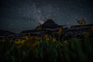
A frequently asked question around here is how to get a reservation at Granite Park Chalet. And it’s a question we love, as the experience provided by Granite Park Chalet is one we would wish on everyone. After all, how else do you get to see Glacier’s star studded skies from the backcountry without having… Read more »
The Impact of Eco-Tourism: Protecting Glacier National Park
Glacier National Park covers over a million acres of land, is amoungst one of the country’s largest National Parks, has two mountain ranges, 130 lakes and one of the most diverse ecosystems in North America. Additionally, the landscape is said to be over 170 million years old, specifically the mountain ranges, which formed in an… Read more »